Where was this
photo taken?
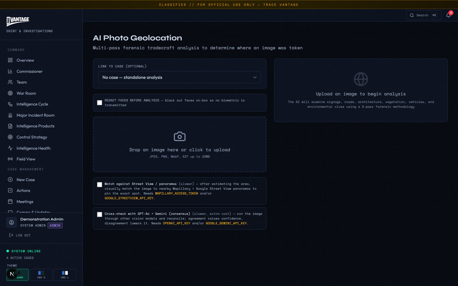
Trace Vantage answers that question from the image itself. A multi-pass engine reads the location an image carries, in its metadata when present and in what it shows when not, then reconciles the passes into a located point with a confidence score and the specific evidence behind it.
The engine produces a forensic lead, not a proof. It states its confidence and its reasoning so an analyst can confirm, challenge or set aside the result. It does not assert certainty, and coverage varies by location.
Metadata gets stripped. The location does not.
Most images an investigation receives arrive with no GPS. Social platforms strip EXIF on upload, screenshots carry nothing, and a seized image may have been re-saved many times. But an image is still a record of a place. The signage, the architecture, the road furniture, the vegetation, the vehicles, the terrain and the angle of the light are all evidence of where the shutter was pressed.
No EXIF
A photo posted to a platform, forwarded through a messaging app or captured as a screenshot has usually lost its GPS tag long before it reaches the case.
Still located
What the frame shows remains. Language on a sign, a kerb profile, a utility pole, a species of tree or a number plate each narrows the ground it could be standing on.
Reconciled, not guessed
No single clue is decisive. The engine runs several independent passes and reconciles them, so agreement builds confidence and conflict lowers it.
One image, several passes, one reconciled answer.
Each pass runs on its own reasoning. Consensus weighs where they agree and flags where they diverge, so the output is a point with a stated confidence and the exact clues behind it, never an unexplained pin on a map.
What each pass reads.
Seven lines of evidence, run independently, then reconciled. Any one may be silent on a given image; the strength of the result comes from where they agree.
EXIF GPS extraction
When the file still carries a location tag, it is read directly and treated as a strong signal, cross-checked against the visual evidence rather than trusted blindly.
AI visual inference
Signage and its language, architectural style, road furniture, vegetation, vehicle types and terrain are read as geographic evidence, narrowing from region to locality.
Landmark resolver
Recognisable structures and named places are matched against a landmark reference to anchor the frame where a distinctive feature is in view.
Ground-truth panorama match
Where street-level or panorama imagery covers the area, the scene is visually snapped to the exact spot. Where coverage does not exist, the engine falls back to satellite imagery and says so.
Solar geometry
Sun position and the direction and length of shadows are cross-checked against the stated date and time, testing whether the lighting is consistent with the candidate location.
Plate & text extraction
Licence-plate formats, receipt and menu text and other legible detail are pulled as corroborating clues that can confirm a country, region or specific premises.
Multi-model consensus
Several models are cross-checked against each other. Agreement raises the confidence score; disagreement lowers it and is surfaced for the analyst to resolve.
Three jobs it does in a live investigation.
Criminal investigations
Place a scene, a suspect or a seized image on the map. An image with no metadata can still point to the street it was taken on, giving investigators a location lead to corroborate against the rest of the case.
Missing persons
Locate someone from a photograph they or others have posted. A background, a shopfront or a stretch of road in a recent image can narrow a search area when time matters most.
Financial-crime asset tagging
The same media pass tags assets in an image, watches, vehicles, bags and jewellery, with value bands, to support unexplained-wealth and lifestyle analysis. Location and lifestyle read from one pass over the same picture.
Asset value bands are indicative and support lines of enquiry; they are not a valuation. See Financial Crime › for how lifestyle and unexplained-wealth analysis fit together.
A lead with its reasoning, confirmed by a human.
Geolocation output is treated as intelligence, not evidence. It carries a confidence score and its supporting clues, is recorded in the audit trail, and is confirmed by an analyst before it informs a decision.
Lead, not proof
The engine returns a located point with a confidence score and stated evidence. It does not claim certainty, and the analyst decides whether the lead holds.
Honest confidence
Street-level coverage varies; where it is absent the result falls back to satellite and the score reflects it. Confidence is framed to the strength of the evidence, never inflated.
Audited & analyst-confirmed
The request, the passes and the result are logged. A human confirms the location before it is carried into the case picture.
Runs inside the force environment under the same governance as the rest of the platform. See Governed AI › for the model-governance and audit picture.
From an image with no metadata to a location you can act on.
The output is not a bare pin. It is a located point, a confidence score and the specific evidence that put it there, a lead an analyst can corroborate, challenge or set aside, with a record of how it was reached.
A located point
Coordinates snapped to the ground where panorama coverage allows, with a satellite-derived estimate where it does not.
A confidence score
Framed to the strength and agreement of the passes, so a strong multi-signal match reads differently from a single weak clue.
A stated rationale
The clues that support the result are listed, so the analyst can see why the engine reached it and test each one.
See geolocation run on your own material.
Walk through the multi-pass engine, the confidence model and the governance around it against your own casework and assurance requirements.